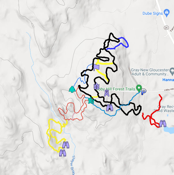
Digital maps provide real time navigation while you are on the trails. There are a growing number of digital maps available for Libby Hill. Below are several for you to choose from. Remember though, to show your location you will need to turn on ‘Location Services‘ on your smart phone for the app that displays the map. Below shows digital maps and the pros and cons of each map. Keep in mind that no single digital map shows every type of trail on Libby Hill due to density of trails.
Avenza Maps – In August 2022, we updated our Libby Hill printed map that now also can be used as a digital map. If you first download the Avenza app for your smartphone, then scan the QR code on the printed map or go to this link to download the Libby Hill Map.
- Pros – exact replica of the printed map that shows your location on the app on your phone.
- Cons – The free version of the app only allows you to load 3 maps otherwise you need to subscribe. However, Libby Hill is one map, and you can also load the Thayer Brook Preserve map and still be under the three-map limit.
Google Maps – A custom Google map for Libby Trails. Points of Interest and trail details are available when you click on them. This digital map will be retired in the fall of 2022 since we now use Avenza maps (see above).
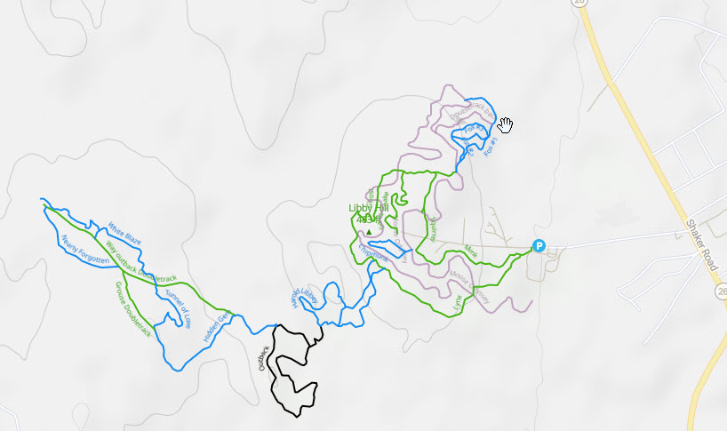
TrailForks – Maps dedicated to mountain bikers. Shows more trail descriptions and heat maps of activity and allows trail comments. It can be used on a browser or their app.
- Pros – Shows narrow unmarked mountain bike trails and marked multipurpose trails.
- Cons – Free version requires you refresh your location every time you want to show your location and limits how many areas you may view. Paid version eliminates this and will encourage you to use their app.
Gray Mountain Bike Trails – This mountain bike trail map on Google maps posted by a local avid biker, provides both Libby Hill and off property mountain bike trails.
Strava – Maps for all types of activities. It, however, doesn’t allow you to see maps unless you subscribe.
- Pros – Provides great fitness trackers and maps of most unmarked and marked trails on Libby Hill.
- Cons – No free access.
Nominate your favorite navigation app – Navigation applications are evolving, if you have one, you’d like added, please let us know.